The nexus between China and the Middle East China-Pakistan Economic Corridor
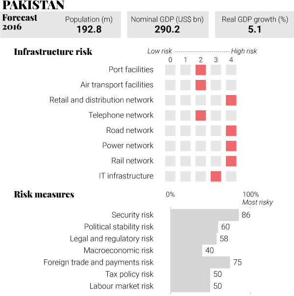
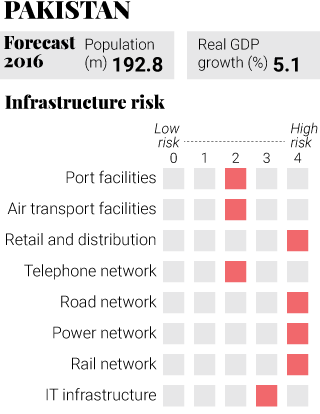
With an estimated US$54 billion worth of infrastructure projects planned for this stretch, the China-Pakistan Economic Corridor is the biggest project under the belt and road banner. It’s taken decades of work to build the road from China’s Xinjiang to Pakistan’s Gwadar Port, but it’s finally partly operational. Chinese cargo began to be transported overland to Gwadar Port late last year. Eventually, sea ports in Gwadar and Karachi will be linked with northern Pakistan, western China and Central Asia. Building the road had been difficult, said Liu Qitao, the chairman of China Communications Construction Group. “We’ve spent decades and 88 Chinese workers have died from natural disasters,” he said.
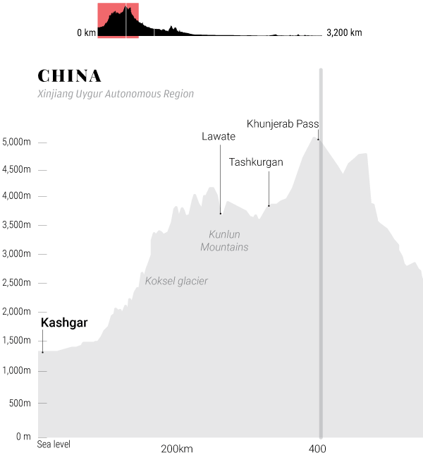 Land elevation of the highway between the region of Kashgar and the Khunjerab Pass on the border between China and Pakistan Graphic SCMP
Kashgar On China’s western border
Kashgar is an oasis city in China’s Xinjiang region with a history stretching back more than 2000 years. The city served as a key trading post along the historical Silk Road.
More recently, Kashgar has been plagued by violent attacks, which Beijing blames on separatists and terrorists. The local government has stepped up police patrols and offered financial rewards for tip-offs about violent attacks.
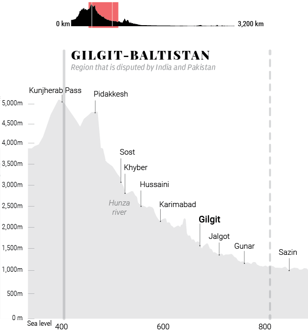 Land elevation of the highway in the Gilgit and Baltistan region Graphic SCMP
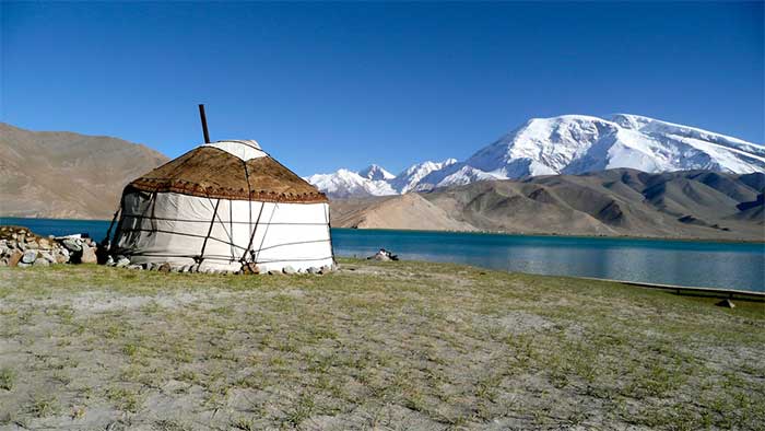
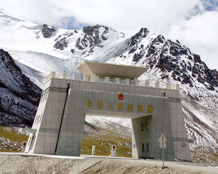
Gilgit-Baltistan A region in conflict
Gilgit-Baltistan is part of the Kashmir region, which is disputed by India and Pakistan. An estimated 1.8 million people live in the region, according to 2015 United Nations estimates.
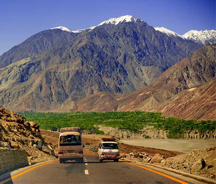
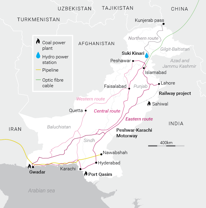
The highly mountainous region covers an area of 72,971 sq km. Trade and tourism are the main economic activities of the region. China boosted investment in 2009 by signing an agreement with Pakistan for a major energy project which included the construction of a 7,000-megawatt hydroelectric dam.
 Source: The Economist. SCMP Graphic
Islamabad Pakistan’s state Head
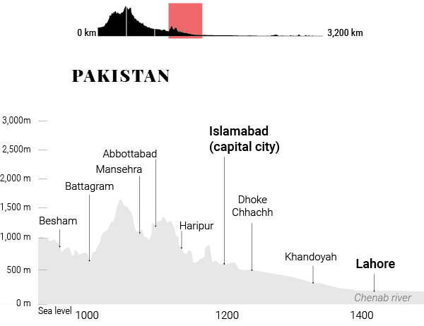 Land elevation of the highway between Besham and Lahore, Pakistan Graphic SCMP
Islamabad is Pakistan’s capital city and has the highest cost of living of any Pakistani city, with population dominated by middle- and upper-class citizens. When Chinese President Xi Jinping visited the city in 2015, he pledged to back US$46 billion of energy and infrastructure projects for the country.
Optic fibre cables, power plants, gas pipelines and highways are some of the projects planned along the busy corridor connecting China to the Gulf of Oman.
Lahore
Lahore is the second most populous city in Pakistan and the nation’s cultural hub. China and Pakistan are currently working together on a US$1.6 billion light rail project for the city - one of the biggest overseas infrastructure projects China is financing. The project faces stiff public opposition, and activists say Lahore’s local government bypassed transparency laws.
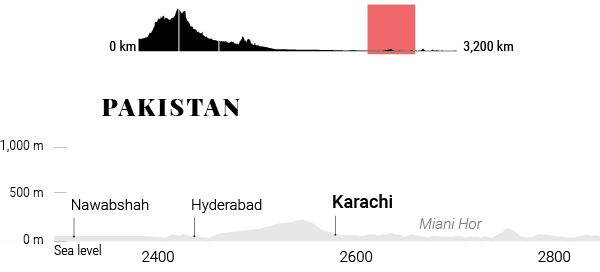 Land elevation on the highway, from Nawabshanh to Karachi. Graphic SCMP
Karachi
The largest and most populous city in Pakistan, Karachi is the country’s commercial and transportation hub. Last year, China and Pakistan launched rail and sea freight services linking China’s Yunnan province to Karachi. The new freight line will cut transport costs by more than 50 per cent.
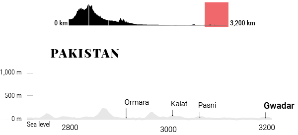 Land elevation on the highway between Ormara and Gwadar. Graphic SCMP
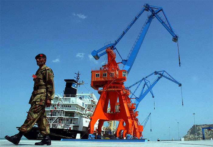
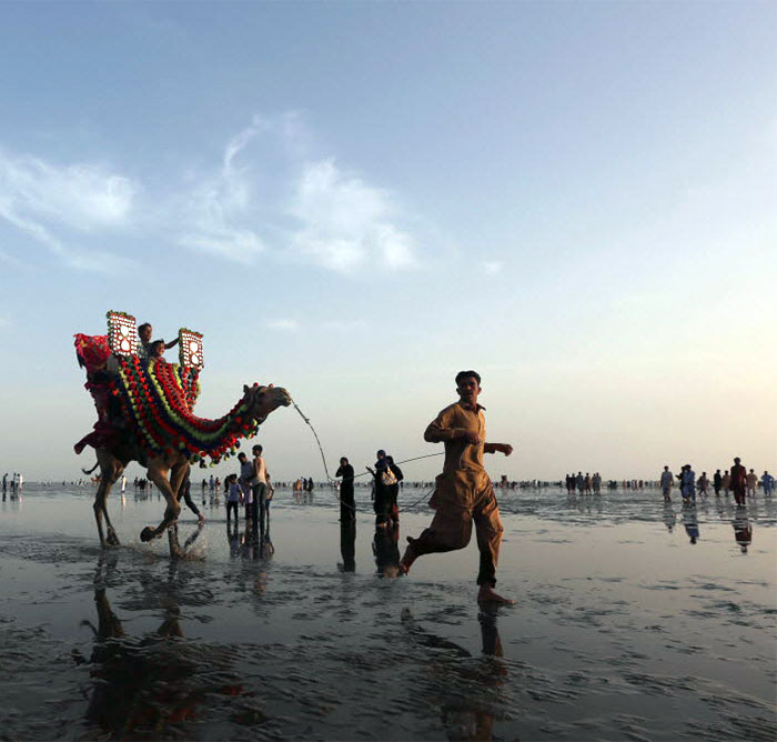
Gwadar Port A modern trade link between land and sea
Gwadar Port in Baluchistan province is a main feature of the China-Pakistan Economic Corridor, and key to the belt and road initiative. China Overseas Port Holding Company plans to expand Gwadar Port, constructing nine, new multipurpose berths along 3.2km of seafront to the east of the existing berths. Pakistan awarded the contract for construction and operation to China in 2013. Gwadar Port will provide an alternative shipping route to the Malacca Strait, which is frequently patrolled by the United States. The shipping route from the Middle East to China, via the strait, is about 12,000km long.